
Stormy Lake – Restoule/Commanda (SW of North Bay-Hwy. 69)
A Lookout Worth Looking For…
by Back Roads Bill
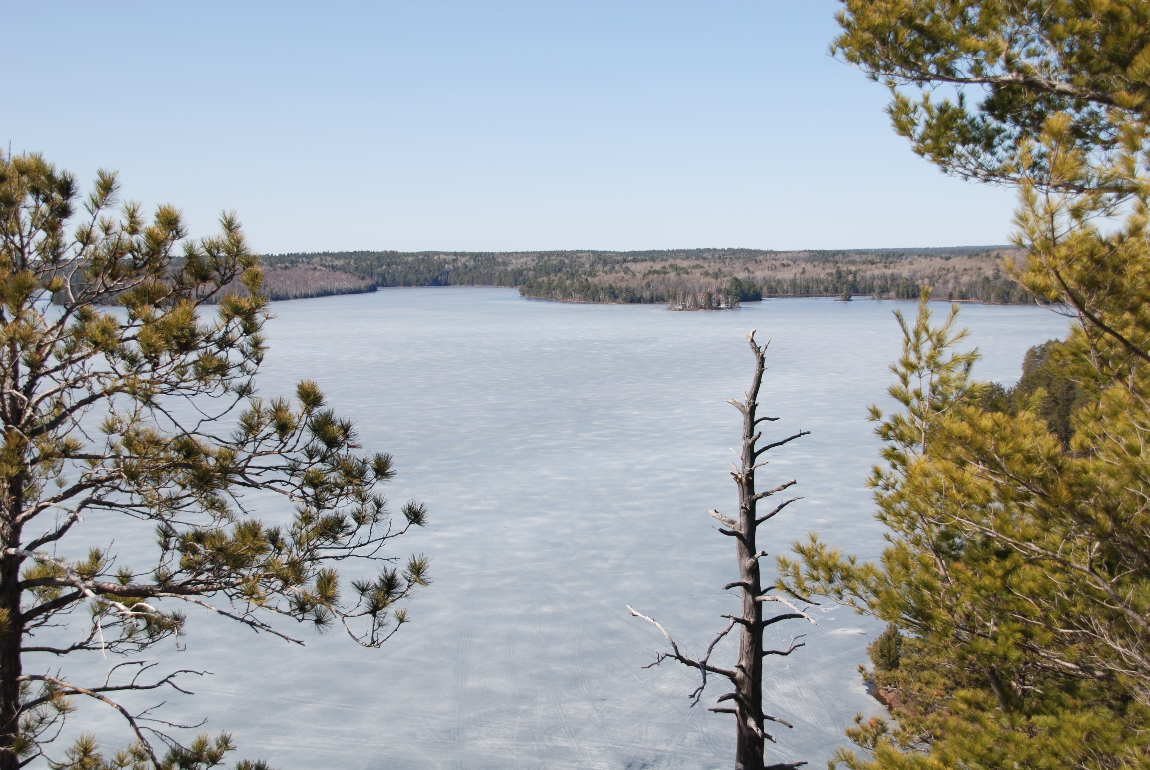 One of the best views in the North Bay area is the Stormy Lake lookout situated within Restoule Provincial Park. It is a worthwhile jaunt to the lookout at any time of the year but the spring/summer, fall and the winter make for a wonderful contrast of colours. It is one of those places you want to return to experience the transitions.
The Park is usually closed early in the fall and winter and there is an easier access to experience this panorama.
Access
You will have to find the Village of Restoule, which is south of North Bay and west of Powassan or Trout Creek. You can journey to Restoule from both of these Highway 11 south communities. The lookout trail, part of the Grawbarger Trail, is located within Restoule Provincial Park but you do no enter the park entrance.
Take Highway #534 to Restoule, which is located on Commanda Lake. There is a variety store, a restaurant and gas in Restoule. Also check out Board’s Honey farm, delicious.
From the Village of Restoule, just before the bridge crossing the Restoule River, turn right and travel 9.3 km. towards Restoule 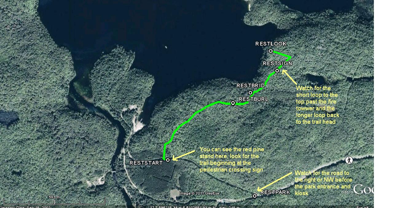 Provincial Park. (Any time of the year, but particularly in the winter, there is a good photo opportunity of the rapids just below the bridge within Restoule.) It is a meandering, up and down, paved road close to Restoule Lake and snakes its way through the hardwoods, a very beautiful drive during the fall colour change.
*You will come to the end of Highway #534. Straight ahead leads you into and towards the gatehouse of Restoule Provincial Park. Veer to the right on to the dirt road. (In the winter you will have to park at this junction, it is a short walk of approximately 600 m to access the trail.)
This road leads to a water access point for cottage owners on Stormy Lake, you can park there and walk back. Your starting point is the pedestrian crossing sign and the blue markers (2009). From the park entrance junction there will be a mature red pine plantation on your left. If you go down the hill to the parking lot you have gone too far.
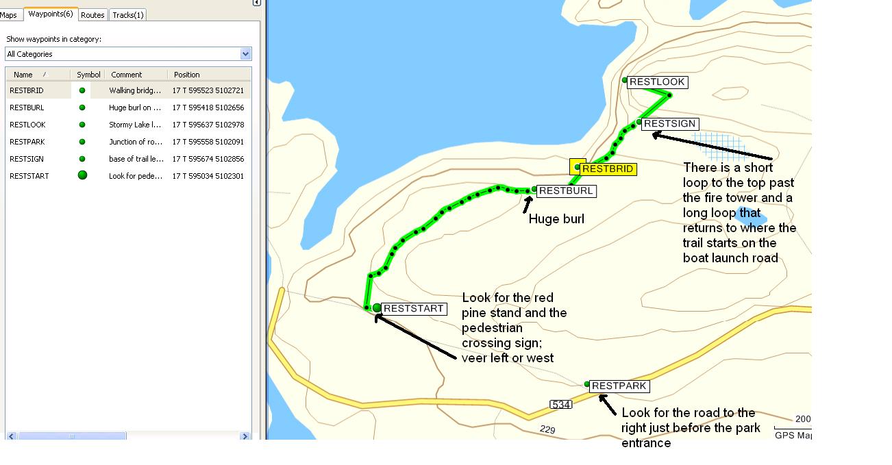 There is no the trail head, again look for the pedestrian crossing sign. As soon as you leave the road, veer to the left or NW. You can also take the trail to the right which is a longer loop. The trail to the left or NW follows along a former road. Within a few paces, watch closely, on the right or to the north the trail will turn towards the lookout. It takes approximately 35-40 minutes, one way, to walk or snowshoe to the top of the cliffs and the lookout. You cannot see the cliffs from the trail, you would have to canoe from the access point, near where you parked, or snowshoe off of the trail at the foot bridge closer to the lookout. (at the peak of winter when the ice is safe venture from the foot bridge and follow the small stream to the lake’s edge; this is approximately 100 m. Take a wide berth away from the stream and out on to the ice and then move towards the steep rock face.)
The predominately flat trail winds its way through a mixed hardwood stand with some hemlock closer to the cliffs. There is always deer sign.
There is a sign just before ascending. It shows you a shorter, 1 km loop leading to the top, clockwise past a beaver pond and back to 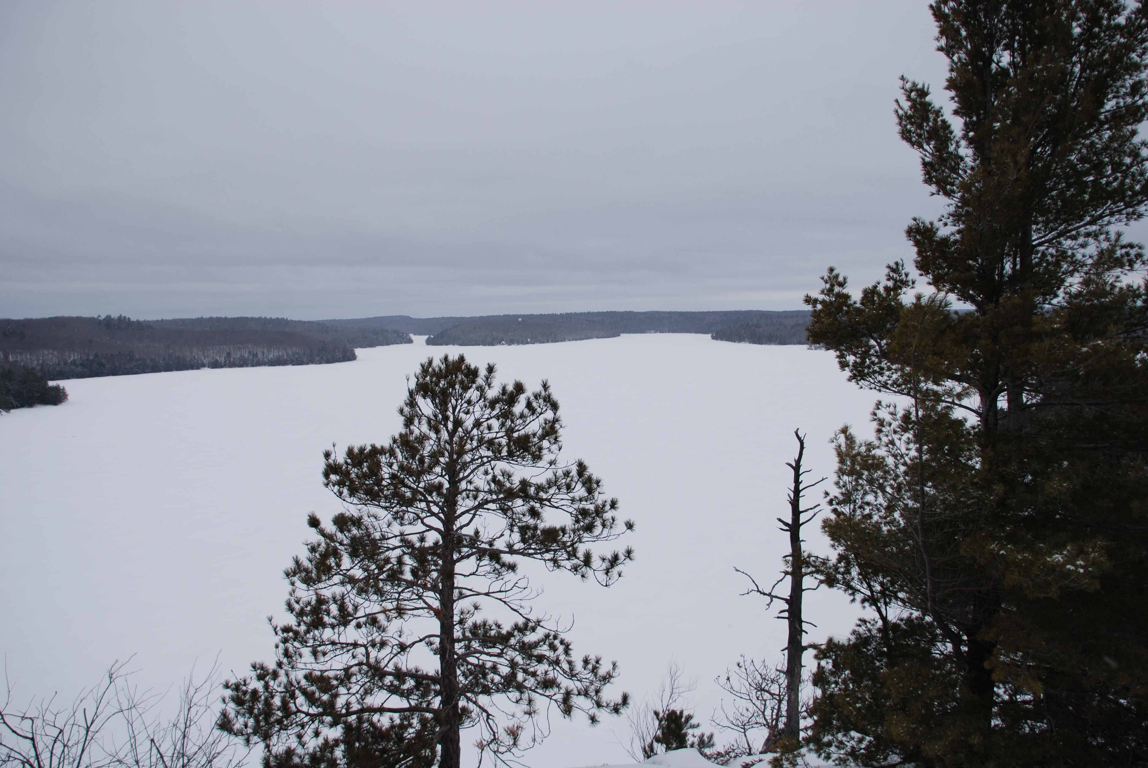 where you are standing. This is a good option.
It is a very short but steep ascent to the top of the cliffs and the lookout. The fire tower will appear behind you when you are at the top. The magnificent view is from the north west to north. To the north you will see Clear Lake, in behind Stormy Lake, and beyond Clear Lake there is Bass Lake. On a clear day you may see Lake Nipissing on the horizon (bring along the binoculars).
There is a canoe route from Stormy Lake to Lake Nipissing (Frank Bay). To the northwest, Stormy Lake changes into the Restoule River.