
Mashkinonje – Noelville – Verner
Where to See the Ultimate Swamp – or Fen, or Bog or Pond
The Best Interpretative Trail
by Back Roads Bill
Just where is the best interpretative trail anyway?
 It is place you will not want to go for a “quick hike.” It is an area where our ecological perceptions are changing. At one time everything was a “swamp,” not a place to go for a holiday or spend some quality time. We are now learning wetlands are important but we still don’t know much about bogs, fens, swamps and ponds. We all have seen a pond or swamp of some description. They take many forms including marshes, estuaries, mudflats, mires, ponds, fens, pocosins, swamps, deltas, coral reefs, billabongs, lagoons, shallow seas, bogs, lakes, and floodplains; some are man-made.
Ecologically speaking wetlands are areas where water covers the soil or is present either at or near the surface of the soil all year or for varying periods of time during the year, including during the growing season. Water saturation largely determines how the soil develops and the types of plant and animal communities living in and on the soil. The prolonged presence of water creates conditions that favor the growth of specially adapted plants and promote the development of characteristic wetlands soils. Marshes and swamps are one of the broadest categories of wetlands and in general harbour the greatest biological diversity and account for almost half of all wetlands throughout the world. Therefore we have different types of wetlands; we should come to know them like some of our familiar coniferous and deciduous trees (the fall colour change is upon us).
The Winner
The wonders of Mashkinonje Provincial Park (pronounced mas-kin-onj) consists of a diverse system of wetlands supporting all the major wetland types; marshes, bogs, swamps, fens and ponds; interspersed with undulating granite ridges that cover more than 2000 hectares between the West Arm and the West Bay of Lake Nipissing. The park counts among its many wetlands two provincially significant areas the Loudon Basin Peatlands and Muskrat Creek.
Nature helped out over time. The parks’ features are the result of a post-glacial lake that covered the area combined with a series of parallel low elevation folded bedrock uplands. The low upland bedrock areas were wave washed with soils eroded and deposited in the depressions. Add the moisture and nutrient variability- wave action on Lake Nipissing and the result are a variety of wetlands habitats that make Mashkinonje a very interesting location to observe nature throughout the year.
But the wonderment is in the trail system is the interpretative signage that has been erected. It is one of Ontario Parks non-operating 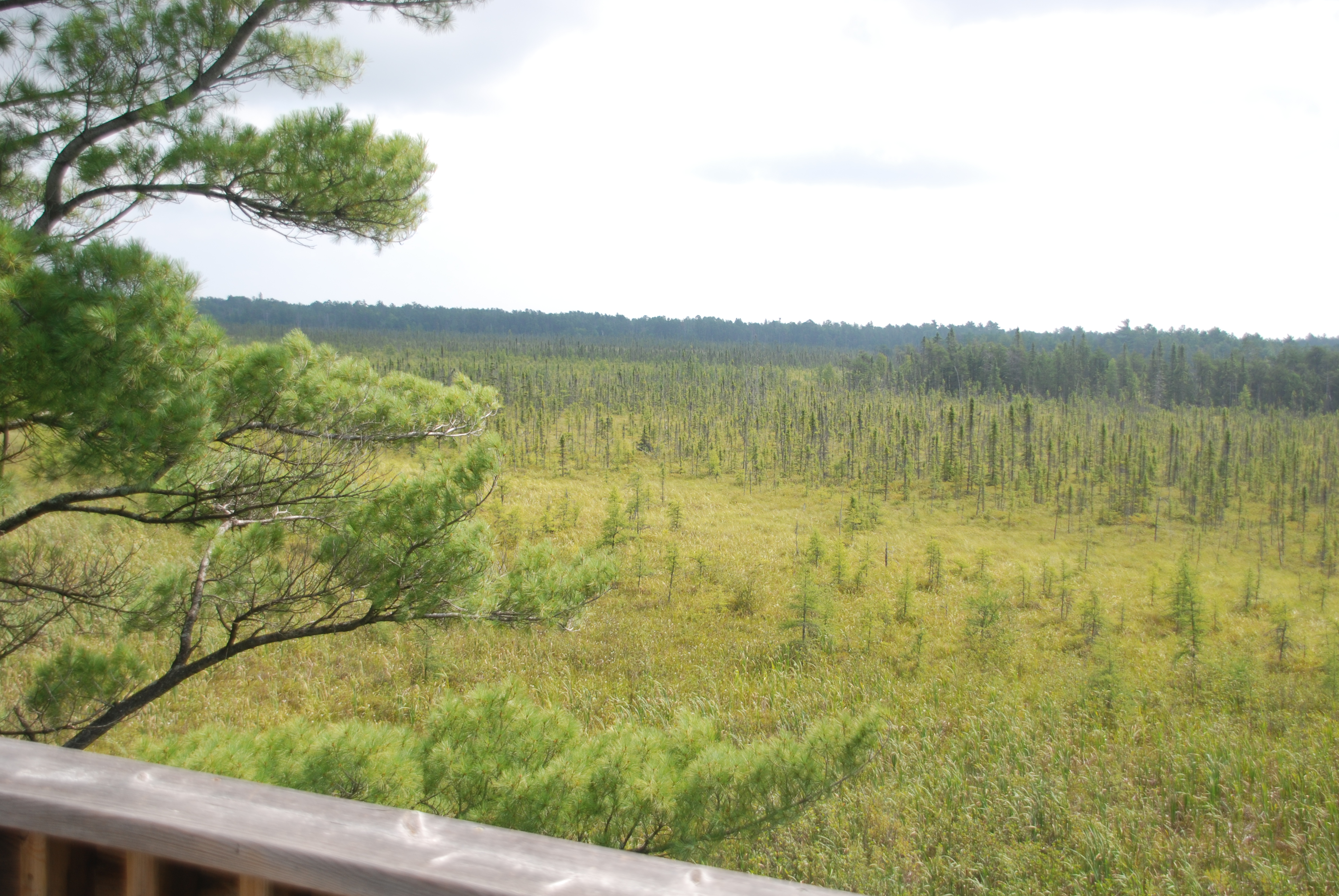 parks (so there are no fees), no operating dollars. The development and maintenance is directly linked to the local species of residents in the area, “the volunteer.”
Angela Martin is the President of the Friends of Mashkinonje. She is also the President of Ontario Nature and owner of a tourism business, Welcome Lodge. As one of the driving forces amongst a dedicated community of volunteers she said, “we recognize the values of this park.” The park was identified by the John Robart’s government of 1963, the park was expanded by the Mike Harris’ ‘Living Legacy” in program in 1997. Originally it was named Haddo Provincial Park on some older topographic maps. Thirty-eight percent of the park is wetland and there are “many little bridges” and board walks totalling more than one kilometre of construction. She explained a steering committee was formed in 1997 and then the Friends’ group in 2000.
“A combined group of community and educational partners have developed a system of hiking trails in the park to make the park features available to the public,” said Mrs. Martin. “The interpretative signage is based on our local appreciation and knowledge of the area.” (Pers. Comm. “It is one of the best,” – Back Roads Bill).
Wetlands Location
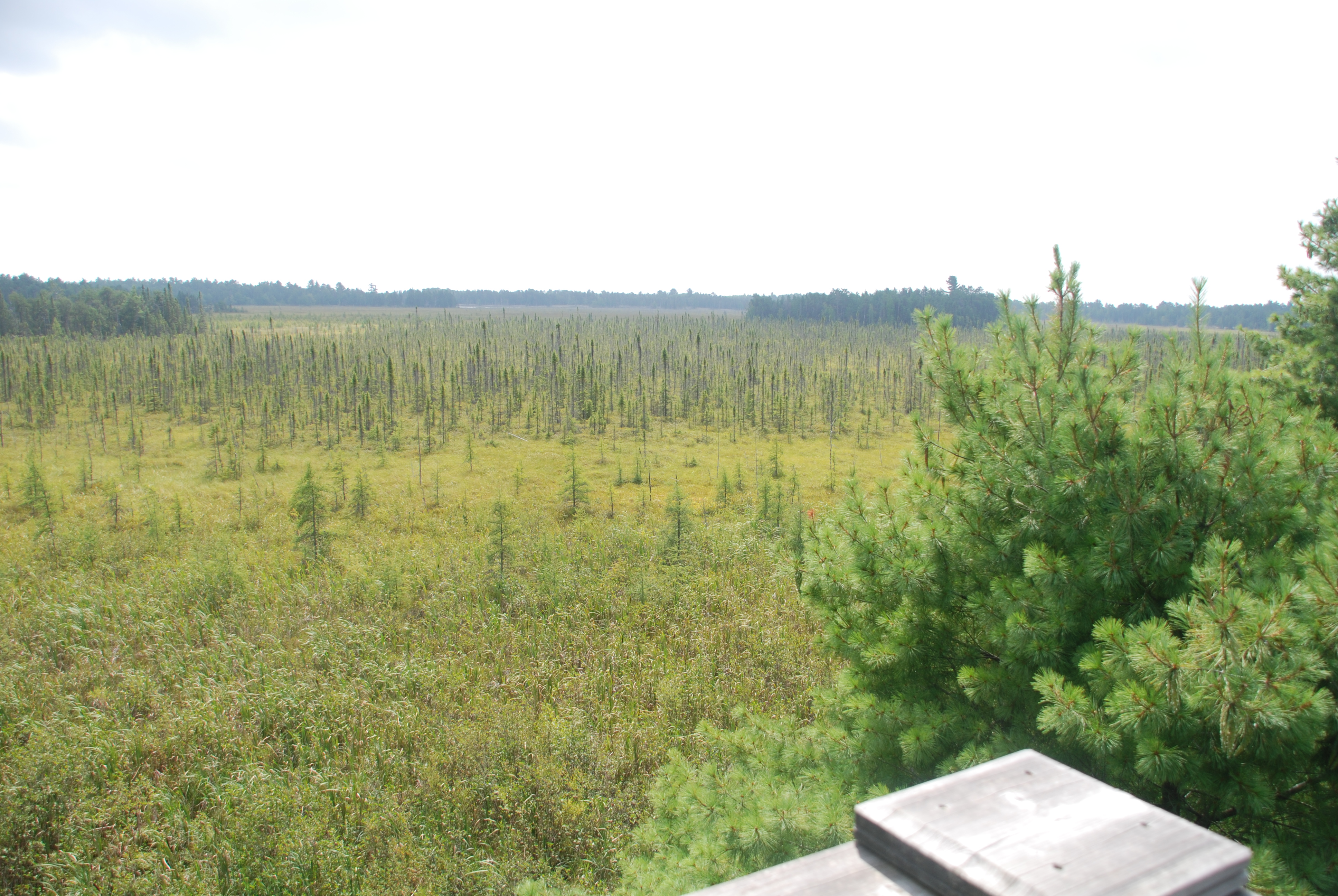
The Loudon Peatland Trail is one choice because of the lookout tower but there are plenty of trails to tackle on other days. On the west side of Highway 64 there are nine loops totalling more than 35 km.
““The Loudon Peatland Trail is the easiest trail; the others have varying levels of difficulty up to the most difficult Coastal Trail. The first half kilometre of the Loudon Peatlands Trail past the boardwalk is wheelchair and stroller accessible, she said. “It is wonderful to see these younger people, they are the future of utilizing trails for all the benefits of being with nature. “ View the newsletter section for the latest information. “We invite you to come, hike and learn about the wonders of our wetlands (www.mashkinonje.com).”
 Looking for a day trip, you can also launch your canoe or kayak at an access point just south of the Loudon Peatland trail and experience the Muskrat Creek leading to a more remote part of the West Bay of Lake Nipissing. The east access is 2.4 km north of the Blanding Access Pt., about 100 metres off of the highway. Then there is the West Arm extension to the west of Highway 64, there is a roadside picnic area to launch from just south of the bridge.
Travel west from North Bay, through Sturgeon Falls on Highway 17 to Verner, turn south on Highway 64 (stop in Verner to read the historic plaque – Reverend Charles Paradis – “the rebel priest.”). Lavigne is 13 km from Verner on the Northwest Bay of Lake Nipissing; an expansive view to the east. Journey fifteen more kilometres to the Loudon Peatland Trail on the east side of the highway. Access to the west network of trails is via the Blandings Access Point, just north of the Chemin Samoset Rd. and just 0.9 km south of Memquisit Rd. Access to the north section of the loops is via Musky Island Rd. A good trail guide is the ‘Trail Guide to Healthy Living’ highlighting trails in the Greater Nipissing /Near North Region, authored by the Greater Nipissing Stewardship Council (info@greaternipissing.ca).
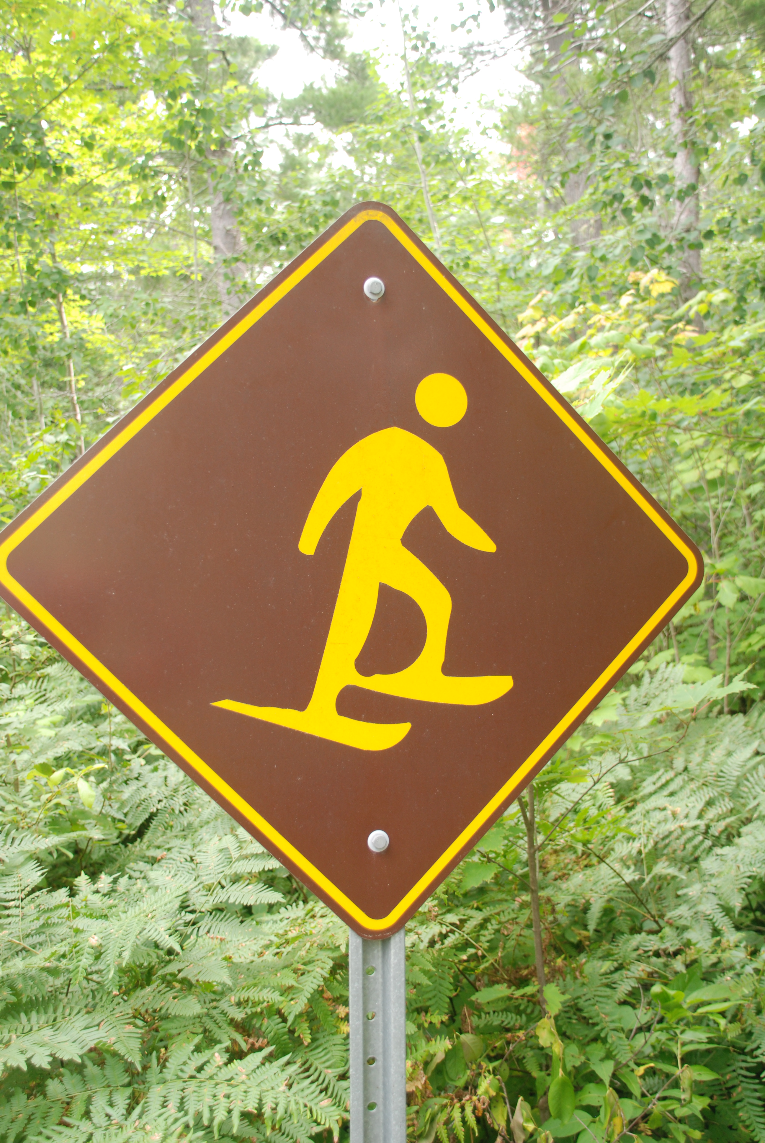
It is one of the few trails to have a designated snowshoe symbol, welcoming the winter pastime (sorry eh?). The lookout tower is located at WGS 84 17 T E 554576 N 5123255 or N46° 15’ 38.5” W80° 17’ 30.6”. It is a very unique view and vantage point to see the extent of the peatland.
Wetlands matter, go and have a look at the diversity which nature gives us at only, the cost of the time, we need to spend.
For maps Download