
Fairy Point – Chapleau Game Preserve
The Rock Fairies – Spiritual Pictograph Site
Take Care for the “Little People”
by Back Roads Bill
 When we hear older legends about fairies, or the “wee folk,” many of us usually create the picture of green pastures in Ireland or maybe the highlands of Scotland. How many people actually think of the fairies being residents of the Northern Ontario, known as the “little people.”
As you round Fairy Point, look carefully into the deep crevices of the granite walls and the quartz veins. Can you see those diminutive beings linked to the metaphysical or supernatural of most Native cultures?
It is those playful, prankish, tiny beings who emerge from their rocky refuge to steal your camping supplies or rock your canoe for no apparent reason. These tiny folk are the Memegwaysiwuk, the fairies whose stone canoes are painted on the wall looking down on you.
There are many pictograph sites in Northern Ontario. The Fairy Point collection on Lake Missinaibi is one of the most extensive in 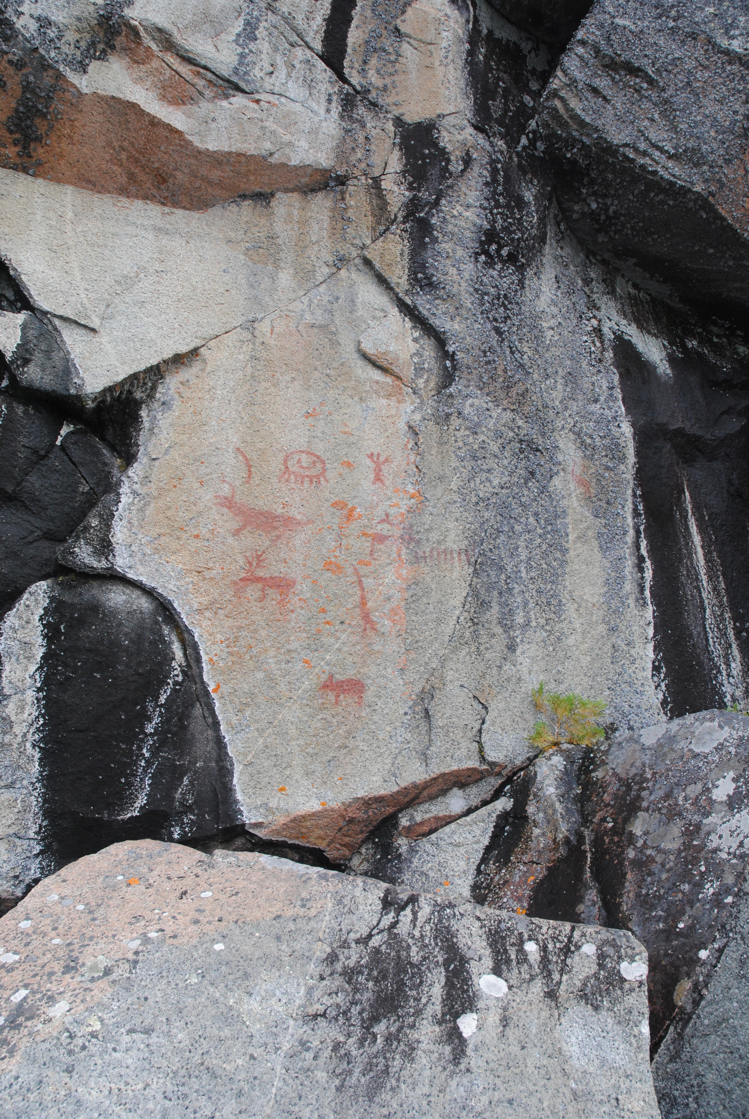 Ontario. It is named after those mischievous sprites that live within the crevices scattered along the sheer rock face.
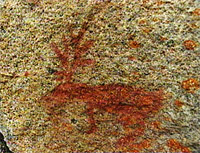
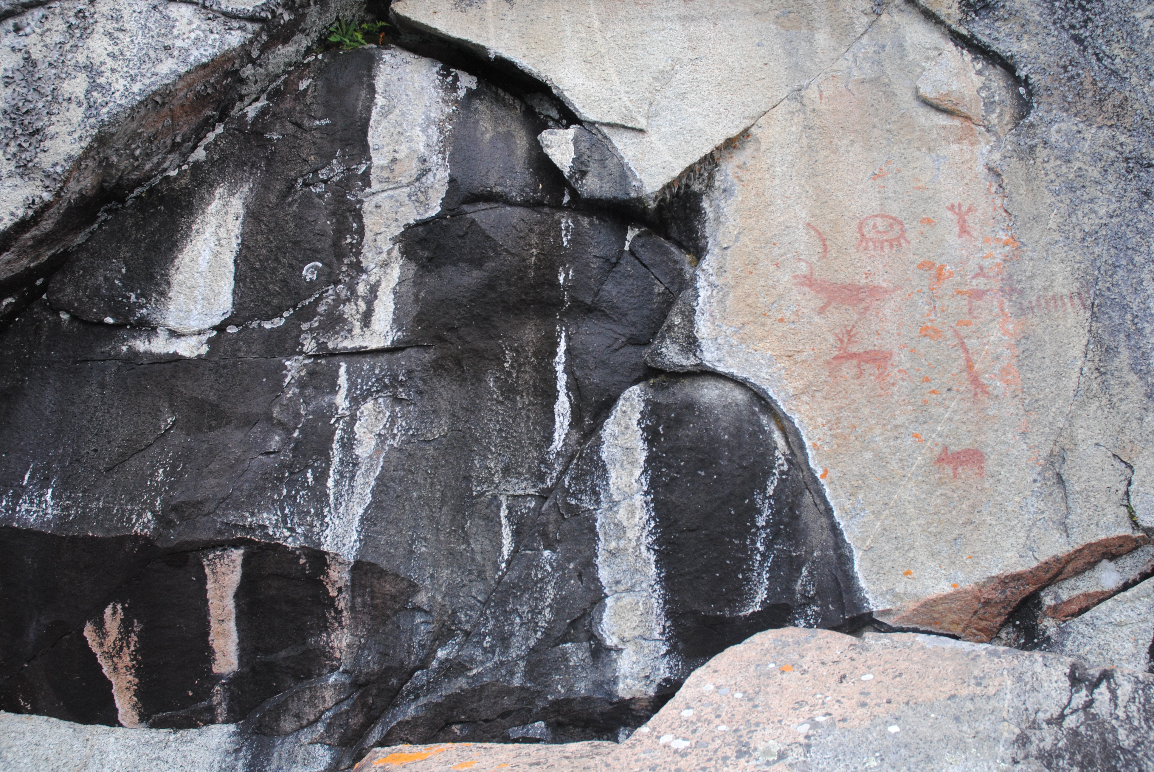
The symbolic images of canoes, fish, caribou and mythical figures that cover a 40-metre-wide swath of rock face the setting sun and are naturally illuminated each day just before nightfall. They have been rendered in a long-lasting red ochre paint, made of a soft iron oxide blended with grease, and protected from the elements by the vertical profile of the cliff. There are also white coloured symbols – a true rarity in North America.
While the age of the Fairy Point pictographs is not known, the name of the river on which they are found indicates that the morphs have existed for more than 200 years. “Missinaibi” is thought to be an English version of the Cree word for “pictured waters.” When European traders first arrived at Missinaibi Lake in 1777, the name was already in use.
Pictography was used by the Cree and Ojibwa (now the Oji-Cree) for both sacred and secular purposes, and included inscriptions on birch bark scrolls, personal totems carved on the trunks of trees, images placed on grave markers, and symbols carved or painted on rocks or boulders. Some rock paintings are thought to have recorded the dreams and visions of shamans.
Among the more than 100 pictographs at Fairy Point, is the rendition of Mishipizhiw (also known as Mishipizheu or Gitche-anahmi-bezheu), an animal manitou associated with the underwater realm, and sometimes regarded as an evil spirit of rapids and troubled waters. (This depiction can also be seen at the Agawa pictograph site within Lake Superior Provincial Park – a drive and walk into; Google: Agawa Rock Lake Superior.) The Mishipizhiw Manitou is a dominant theme in Cree-Ojibway spirituality.
 Mishipizhiw, was both feared and revered as a demi-god of the water. Sometimes taking the form of a menacing, snake-like creature with sharp teeth, horns, and “power lines” emanating from its body, Mishipizhiw was also pictured as fiercely feline (the “Great Lynx”, “great underwater wildcat,” “underwater panther,” or “fabulous night panther”). Like other manitous, Mishipizhiw had the power to shape-change into various animal forms.
There is also a human-like figure arms extended both skyward and earthward. Interpretations suggest it is a depiction of a medicine man and its meaning, “I take the sky, and I take the Earth.” The Midewin, a secret society of some Native groups explain religious beliefs or the world view of the Anishinabek (First Peoples).
Of significance are quartz veins that frame the bottom of the rock face in a “V” shape. There is a serpent morph actually touching it. It was believed quartz veins were left by lightning strikes. Snakes show up in many medicine songs and 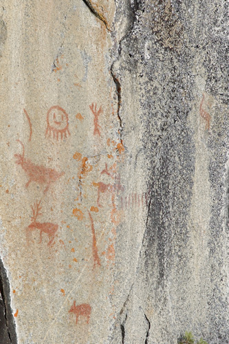 suggest comes in the form of lightning from above and below the Earth.
There are also white crosses. Some think it denotes the Christian missionary presence. Others believe the cross, like the elaboration of the swastika; indicate the four cardinal directions and the four wind manitous.
Fur Trade Era
For 140 years spanning the 18th and early 19th centuries, the Missinaibi River, with its links to Lake Superior and James Bay, was one of the most important fur trading routes in Ontario.
After being reprimanded by the Governor of New France for illegal trading, Pierre-Esprit Radisson and Médard Chouard Des Groseilliers took their discovery to England. This in turn led Britain to claim the entire watershed of Hudson Bay and in 1670 established what became Canada’s oldest and historically most important company, the Hudson’s Bay Company (HBC).
Missinaibi is in fact the height of land separating two drainage systems. Trading rivals from the highly competitive fur trading companies, the Hudson’s Bay Company and North West Company both built trading posts on the lake in the 1770’s. The NWC moved their furs south to Lake Superior while the HBC sent their furs towards James Bay.
Have a Look
These pictographs are best seen from the water, in a canoe or snowmobile in the winter. It is a camping trip unless you are in a motor boat and are on the lake for a day trip. Think about a kayak adventure the lake is more than 40 km long and 20 km on both sides of the wish-boned shaped lake.
Access is from Barclay Bay, at the Missinaibi Provincial Park (Ontario Parks) access point; which is approximately 90 km from Chapleau. You are within the Chapleau Game Preserve, bears and moose are a fact of life and can be seen en route.
From Barclay Bay it is approximately 19 km, SW to Fairy Point (WGS 84 17 U E296659 N5357966 or N48° 20’ 31.6” W83° 44’ 39.2”). There are also two canoe routes trips within this Canadian Heritage River on the Missinaibi to research, Route, Part 1: Missinaibi to Mattice – (238 kilometres) and Part 2: Mattice to Moosonee – (316 kilometres)
There is much to do on the lake. It is worth spending a number of days here to explore Reva Island south of Fairy Point , where there is a stand of 350 year old white and red pine; pickerel (walleye) fishing at the base of Whitefish Falls, at the end of the Little Missinaibi River (the entire lake is known for its good fishing and natural recruitment. Upstream from Whitefish falls are kettle formations decorated with unusual pictographs; and inland from the isolated Baltic Bay is a day hike to the old Borasso Lumber camp, with the remains of barracks, stables, dining hall, store and outhouses.
Take care while there, there are too many legends and beliefs in these little people to ignore the possibility of their existence; they are mysterious and unpredictable. And if a fetch comes up on the elongated lake you will know then, the tiny tormentors are thereabouts.
For maps and GPX Download