All Star Surveyor – Niven’s Meridian – Cochrane
Not by Chance Lines – Straight Roads and Boundaries
by Back Roads Bill
 Some lines are more important than others and these lines are not online or the dramatic lines of actors. Three of the most significant imaginary lines on the surface of the Earth are the equator, the Prime Meridian and the International Date Line.
There is a lot of history in our province and much of it is found on the roadside sometimes literally. You have been wondering where all those dark blue highway plaques come from anyway. The stories are interesting to read and you wonder about the location.
There are about 1,200 provincial roadside plaques across Ontario, each commemorating people, events and places that define our heritage. There is one plaque that has much to do about our back roads and its very specific location tells us why the byways appear as straight lines, running north-south (not including the curves that circumnavigate  wetlands, rock cuts and hills).
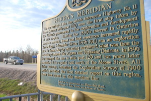
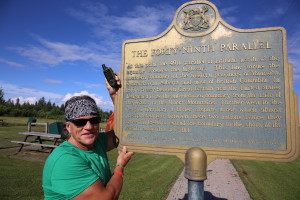
It is located three kilometres west of Cochrane on the north side of Highway 11. It is found at N 49° 03.524’ W 081° 04.449’ or 17U E 494582 N 5433987. It is interesting; the plaque is on the 49th parallel of latitude north of the equator, the western boundary between Canada and the United States. But it is the 81st line of longitude, west of the Prime Meridian, that is important to Northern Ontario; it is the most important imaginary line we have called the Niven Line.
The Important Niven Line
Land surveyors were the “forerunners” of settlement. Dispatched into the wilderness, in what was known as “New Ontario,” the “Northern” came later; they were the first to examine the land in detail; their words were taken as the gospel and what followed were development and colonization roads. Some became known as roads of “broken promises and shattered dreams” when the land was not fertile and the hardships were many. Where the land seemed good, they laid out, as directed by the government, the original townships and lot lines.
Paul Goodridge is an Ontario Land Surveyor and is the Manager of the North Bay Geomatics office of Stantec Engineering and a former member of the Insurance Advisory Committee of the Association of Ontario Land Surveying. He said, “Alexander Niven essentially established the framework for all the township surveys in the northeast and was generally regarded as Ontario’s greatest land surveyor.
“His challenge was enormous, to begin with, not only was the landscape inhospitable; the true north-south lines (meridians) are not parallel; they converge toward the north pole. This means the network of townships he surveyed have meridians as sidelines and are invariably narrower along the north boundary than they are along the south. This narrowing is slight but measurable and has to be accounted for. With the rudimentary equipment of the day he surveyed with amazing accuracy and to this day his body of work across Northern Ontario can be considered exemplary.”
Because the survey grid created is not actually drawn on the land, physical markings had to be established. Niven set out to eventually run a meridian from Georgian Bay to James Bay. In order to avoid land disputes and to keep land measurements accurate, hundreds and thousands of monuments (and iron bars) have been planted in the ground to mark survey boundaries.
He was in the north in 1881 establishing a baseline of latitude from the north-east corner of Field Township, establishing a tier of townships, to the south end of Lake Temagami. He soon discovered the Little Clay Belt in the Temiskaming Shores area. “Admirably suited for agriculture,” he said. “…the soil being clay and free of stones…” Exactly the type of land the government had been hoping to find.
And then another discovery, “…we enter upon good land, the level country that extends to James Bay, and for the remaining 200 miles (321 km) of the line the country is almost as smooth as the lawn in front of the Parliament Buildings…a splendid tract of farming land, clay soil, often covered with black muck. Parts of it might be called swampy and parts of it muskeg, but taken altogether there are not many places in Ontario where a line can be run for the same distance through such an even uniformly good tract of land. A good deal of it can be drained and cultivated.” It was to known as the Great Clay Belt and would lead the government astray for many years. It is one of the reasons we have two Trans Canada Highway “11’s” in the north; both starting in North Bay and joining in Nipigon; your road map will help.
Niven, by now the star performer he established a number of base lines in north-western Ontario for a grid of townships. He tied his survey in the western extension forty-ninth parallel. In 1896 he was given the job to ran an exploration line north to James Bay that would be the northerly extensions of the boundary of what would become the Districts of Sudbury, Temiskaming and Cochrane. Running some 483 kilometres (300 miles) of forest, lake, swamp and muskeg the completed boundary line became known as the ‘Niven Meridian.’ It was the only line to reach salt water. By 1900 he had he had run well over 1600 kilometres (1000 miles) of base and meridian lines throughout Northern Ontario.
Alexander Niven set the stage on which we now live. Like the set designer, on the theatre program, the name is  rarely noted or remembered, they are not the actors.
You can on online to the province’s heritage plaque guide and discover all of the roadside sites, see www.heritagetrust.on.ca . There is also the Federal government’s Historic Sites and Monuments Board of Canada plaques (www.pc.gc.ca ); these bronze and aluminum plaques vary in colour. Since you are in the Cochrane area, there is a 49th parallel plaque on Highway 11, just south of Cochrane. Although the back roads are not asphalted, take a few moments to read these plaques and think about those who came before us and paved the way, especially if you have wondered why property lines and municipal boundaries are straight by sight and on the maps.
GPX