
Newman Mine – Uranium – Lake Nipissing
Heritage Past – Mine Landmark in the Present and Future
by Back Roads Bill
Many back roads lead us to stories.
We choose our land and water jaunts with an eye for scenery, heritage and nature. The Manitou Islands have all of that. Depending on where you are on the North Bay shoreline or driving down Airport Hill, the islands, on some days, seem to rise up or float on the horizon. The cluster of five islands often looks closer than the eight kilometre distance, from the “government dock.”
The Manitou islands are part of an eroded volcanic pipe. The vent was formed by the violent, supersonic eruption of a deep-origin volcano. The resulting magma that is pushed toward the surface is now the islands; an aerial view reflects the circular rim.
It is now a non –operating, provincial park, a nature reserve. The islands are important to more than 50 species of breeding birds and include significant Great Blue Heron colonies, and osprey nesting sites (one of the largest heron rookeries in Canada). The Little Manitou Island has a small limestone quarry and kiln that was used for mortar in the construction of the Canadian Pacific Railway in the early 1880’s. There is a beautiful beach on the Great Manitou Island, popular with boaters; the north side has an abundance of fossils.
First Chapter
![Newman_Mine[1] (2)](http://www.steerto.com/wp-content/uploads/2015/09/Newman_Mine1-2.jpg) In the 1950’s the “Cold War” was on and nuclear weapons meant uranium exploration was in demand. Prospecting indicated the presence of uranium and niobium (used in special steel alloys) on Newman Island. A mine head frame was constructed and 135 metre, vertical shaft was sunk in 1953 with several horizontal drifts.
In the 1950’s the “Cold War” was on and nuclear weapons meant uranium exploration was in demand. Prospecting indicated the presence of uranium and niobium (used in special steel alloys) on Newman Island. A mine head frame was constructed and 135 metre, vertical shaft was sunk in 1953 with several horizontal drifts.
Bill Schorse lives near Corbeil, his father was the Treasurer of the Inspiration Mining and Development Co. He said Lake Nipissing had its own television version of ‘Ice Road Truckers.’ It was “like an early gold rush with widespread exploration, drilling occurring through the ice.” Transport trucks brought supplies from North Bay to Calder and Newman Islands. During the open water season barrels of diesel (which is lighter than water) fuel were towed in the water by the tugboat Mel Thompson to the site.
From a February 29, (yes it was a leap year) 1956 geological report, “A floatation plant to upgrade the ore before chemical treatment is now in operation.” In another reference it states there is 13 000 tons of rock stockpiled for the plant (located on the north shore, Nova Beaucage Rd.)
It became a “separation” problem to extract the uranium from the ore. During the short tenure of the mine a Swedish company became a partner and further attempts were made to extract the uranium at the processing plant. The company’s name changed to Nova Beaucage. All attempts failed and the mine was closed.
Newman Island was inspected four years ago by the Ministry of Northern Development and Mines with Ontario Parks staff. Technical guidance for mitigation and rehabilitation procedures, as per the Mining Act, was identified. The head frame has fallen down and what remains is the ore chute amongst the poison ivy that thrives on the island.
New Chapter
Native people have had a connection to the islands seasonally for thousands of years; and it is the reason the islands 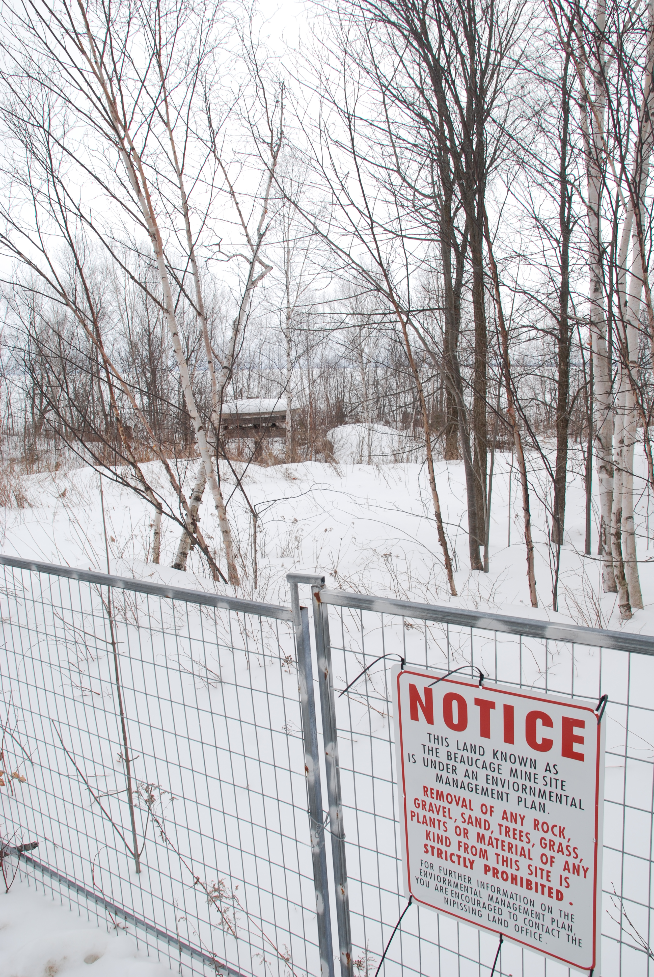 are recognized in the name Manitou (Great Spirit). Nipissing First Nation now faces another challenge, not on the islands but on the mainland.
It was about one year ago Chief Marianna Couchie identified the contaminated site at a federal Standing Committee on Aboriginal Affairs and Northern Development (Tuesday, March 13, 41st Parliament, # 029). During the testimony she said, “… In their processing they left behind radioactive materials…Today people can’t go there; we have it barricaded off…We do want the material moved off our reserve.” It was the processing plant that received the ore that created what remains today. It is known there is high incidence of radon gas associated with mine processing. It is a gas produced naturally by the breakdown of uranium in soils and rocks. You can’t see, smell or taste radon. When diluted in open areas it does not pose a health risk. Recent scientific studies have linked an increased risk of developing lung cancer due to exposure to radon gas in confined spaces, like homes.
There are over 21,000 federal sites listed in the Federal Contaminated Sites Inventory maintained by the Treasury Board Secretariat, including about 7,000 confirmed contaminated sites and about 6,000 suspected others. Approximately 9000 are listed as “closed” because remediation is complete or because no action was identified as necessary during assessment. There are 66 in the Nipissing-Temiskaming riding. The Nova Beaucage Rd. site is not yet listed; it is posted as a contaminated site by Nipissing First Nation.
The mine shaft was located at WGS 84 Zone 17 T 17 T E609551 N5123300 or N46° 15’ 16.0” W79° 34’ 43.2”. From Newman Island the tugboat and barge journeyed approximately nine kilometers, almost due north to stockpile rock on the shore. To interpret what was and is, drive west from Gormanville Rd., 6.8 km from Duchesney Falls to Nova Beaucage Rd. You will drive, left or southwards towards the lake, over the tracks and veer left or SE, houses line both sides of the road until you come to the fenced off area at 17 T E610582 N5132256 or N46° 20’ 05.5” W79° 33’ 47.5”. To the south horizon you can see the Manitou Islands.
In today’s context, with modern mining practices, government policies and First Nations’ land management this kind of decommissioning would not occur. This back roads story has a beginning, the original characters have long since left the storyline; the setting for the next chapter is now on shore, with new players; the next chapter remains to be written.